Airborne Surveying
To achieve the most accurate subterranean interpretation, ANE includes an airborne surveying phase in its exploration strategy. The airborne surveying phase involves acquiring a grid of Gravitational, Magnetic and Radiometric data by flying a customised gyrocopter over the exploration area.
The image below illustrates an example of a flight plan ANE created for a potential Middle Eastern Exploration programme.
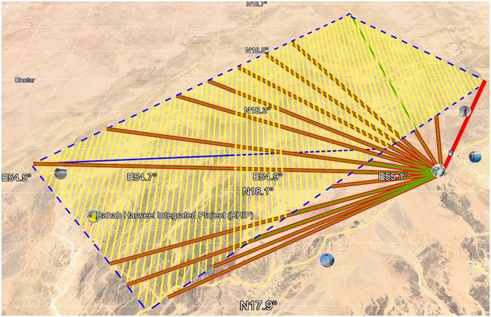
Potential aerial survey flight plan for Middle Eastern exploration programme.
Traditionally exploration cost increases as the distance from which the data was collected from the ground decreases. Typically, airborne surveying costs 1/10th of ground surveying, and similarly, satellite surveying costs 1/100th of airborne surveying. Furthermore, exploration data quality increases as the distance from which the data was collected from the ground decreases. ANE, therefore identified a problem, it required high quality, high resolution data, while still maintaining a low-cost exploration strategy.
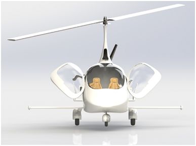
AutoGyro’s modified Cavalon gyrocopter fitted with a sensory boom
ANE’s solution is to conduct its airborne surveying phase using a specially modified Cavalon gyrocopter, fitted with a sensory boom. The Cavalon gyrocopter is unique in that: it is capable of flying at a low altitude, a slow speed, can support the weight of the sensory equipment, and is cheaper and more fuel efficient than other potential aerial vehicles.
ANE works in partnership with AutoGyro, the manufacturer of the Cavalon gyrocopter, and together we have designed the gyrocopter to suit ANE’s exploration needs. The modified gyrocopter is fitted with a gravimeter, a magnetometer, radiometric equipment, and a sensory boom.