Aeromagnetic Surveying
Aeromagnetic surveys are conducted to detect variations in the earth’s magnetic field. In this surveying technique, an aircraft equipped with a magnetometer flies in a grid-like pattern over an area of interest. As the aircraft flies, the magnetometer measures and records the intensity of the magnetic field at the sensor.
The intensity of the magnetic field is a combination of the field generated in the earth, as well as tiny variations due to the temporal effects of the constantly varying solar wind, and the magnetic field of the aircraft. By subtracting the effects of the solar wind and aircraft, an aeromagnetic map can be created which details the abundance of magnetic minerals in the upper levels of the earth’s crust.
Because different rock types, and mass quantities differ in magnetic properties, the aeromagnetic data can be processed to create a visualisation of the geological composition of the upper crust. This technique is particularly useful in identifying the depth of base rock, the depth of sedimentary layers, and the location of fault lines within the upper levels of the earth’s crust.
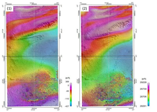
Aeromagnetic survey of the Namibian concession.
ANE commissioned an analysis of aeromagnetic survey data collected by the Namibian government. This has improved our understanding of the concession’s subsurface geology by providing a 3D model of the basement rock’s formation (See figure 7). The data ANE now has on the basement has furnished us with three valuable insights.
Firstly, a number of steep and well defined anticlinal structures are visible, creating the possibility that the correct geology has formed above for hydrocarbons to migrate towards the surface and become trapped. Secondly it gives indication of fault lines which could produce hydrocarbon traps. Finally, a better understanding of the subsurface geology has allowed us to anticipate potential drilling complications.
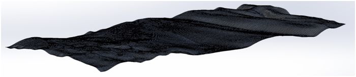
Visualisation of aeromagnetic data describing the base rock beneath the Namibian concession.