Gravimetry Surveying
Gravimetry surveying was one of the first geophysical methods to be used in hydrocarbon exploration. As the name suggest, this method uses accurate measurements of the Earth’s gravitational field to locate horizontal and vertical variations in the density of subsurface rocks. Much like aeromagnetic surveying, an aircraft fitted with a gravimeter flies in a grid like pattern over the area of interest, measuring and recording the earth’s gravitational pull.
Because different rock types and mass quantities differ in their gravitational pull, the gravitational data can also be processed to create a visualisation of the geological composition of the upper crust.
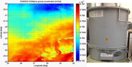
On the left are gravitational data readings from a Southern African concession. On the right is the Gravimeter which ANE has access to through its partnership with Rolf Heyen
ANE has partnered up with Rolf Heyen, head of the institute of flight guidance at the University of Braunsweig in Germany, to conduct gravimetry in tandem with aeromagnetic surveys from the modified gyrocopter. ANE believes that analysis of data from both surveying techniques is necessary to create a highly accurate visualisation of the subterranean geology.